RARE ROYAL SIZE OF 5732M2
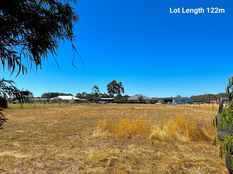
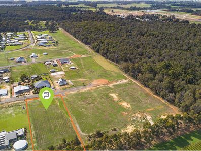
King size 5732m2 lot offering a sensational amount of South West space to live the ultimate country lifestyle.
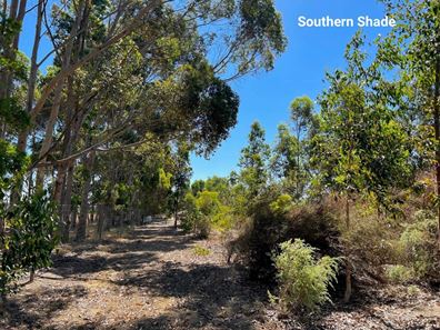
Enjoy a perfect northern aspect , timber top bushland views across the Wardandi Nature trails, clean easy level countryside for your future ranch, generous workshop or future studio.
Settle your future on the banks of Witchcliffe town centre, founded in 1926 and still today one of the quaintest south west country towns with a very bright future. Enjoy a leisurely 6.6km walk or ride under the forest canopy, through winding valleys and farmland on your way to Margaret River.
The Indian Ocean is 10mins to the west, Southern Ocean 25mins to the south where the almighty Blackwood River meets the sea all surrounded by national parks and world class vineyards…. this is the ultimate lifestyle less than 10mins to Margaret River for every day amenities, schooling, service industry and extra recreational activities.
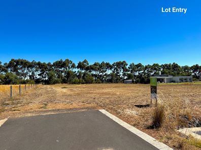
A perfectly orientated north facing property with rural style fencing to the southern, eastern and western boundaries with just loads of space to create a better life.
Ready to build on now and located in the heart of the Margaret River Region, secure the best 5732m2 block on the market today.
For immediate assistance please contact Tony Farris on 0417 951 838, this block will just not last.
Listing snapshot by reiwa.com
This land listing located in Margaret River was sold by Tony Farris at Ray White Stocker Preston.
If you would like to get in touch with Tony Farris regarding 35 McDermott Parade, Witchcliffe, Margaret River, please call 0417 951 838 or contact the agent via email.
Margaret River overview
The townsite of Margaret River is located in the south west agricultural area, 277 kilometres south southwest of Perth and 48 kilometres south southwest of Busselton. It is located on the Margaret River from which it derives its name. The precise origin of the naming of the river is not known, but it was possibly named by John Bussell in honour of Margaret Wyche, a friend in England who was expected to follow the Bussell's to Australia. The name is first shown on a map of the region published in 1839.
In 1910 the Margaret River Progress Association wrote to the Minister for Lands requesting a townsite be declared at "the Upper Margaret Bridge". The reason given was that "the district is likely to be dotted with public buildings several miles apart in the near future if a townsite is not made available shortly". The District Surveyor who inspected the area preferred an area near the lower bridge on Caves Road, but this land was not available. Lots were surveyed in 1912, and the Townsite of Margaret River gazetted in 1913. In 1918 the name of the townsite was changed to "Margaret", but it was changed back to Margaret River in 1927, due to local usage of the name always being Margaret River.


